Login or Sign Up
Logging in...
Remember me
Log in
Or
Sign Up
Forgot password or user name?
Log in with
Forums
Blogs
Articles
Groups
Galleries
Member List
Calendar
Home
Forum
Simply Business
Fucking Around & Business Discussion
Google Maps or MapQuest?
Google Maps or MapQuest?
Collapse
X
Collapse
Posts
Latest Activity
Photos
Page
of
1
Filter
Time
All Time
Today
Last Week
Last Month
Show
All
Discussions only
Photos only
Videos only
Links only
Polls only
Events only
Filtered by:
Clear All
new posts
Previous
template
Next
Amputate Your Head
There can be only one
Join Date:
Aug 2001
Posts:
39075
Share
Post
#1
Google Maps or MapQuest?
04-23-2010, 05:12 PM
Which one do you turn to when you need precise directions or distances?
I prefer Goog Maps, but my wife (still feels weird saying that) prefers MapQuest.
13
Voters
Google Maps
0%
8
votes
MapQuest
0%
3
votes
Other (Name it please)
0%
2
votes
SIG TOO BIG
Barefootsies
Choice is an Illusion
Join Date:
Feb 2005
Posts:
42635
Share
Post
#2
04-23-2010, 05:13 PM
Now,... I prefer Google Maps. But for a long time I used to use the other.
Google is just simpler, I think.
Should You Email Your Members?
Link1
|
Link2
|
Link3
Enough Said.
"Would you rather live like a king for a year or like a prince forever?"
Comment
Post
Cancel
CaptainHowdy
Too lazy to set a custom title
Join Date:
Dec 2004
Posts:
94735
Share
Post
#3
04-23-2010, 05:14 PM
I like Google Maps...
YOUR AD HERE!
Comment
Post
Cancel
La_Sexorcist
Confirmed User
Join Date:
Feb 2010
Posts:
337
Share
Post
#4
04-23-2010, 05:22 PM
Google maps! Mapquest gave me pretty jackassy directions once.
Comment
Post
Cancel
Serge Litehead
Confirmed User
Join Date:
Dec 2002
Posts:
5190
Share
Post
#5
04-23-2010, 05:26 PM
Google maps
when I check out traffic around NYC area i load all three gmaps, yahoo maps and ms live maps.
SilverCrocodile.com
Adult web design
since '05
Comment
Post
Cancel
fatfoo
ICQ:649699063
Join Date:
Mar 2003
Posts:
27763
Share
Post
#6
04-23-2010, 06:12 PM
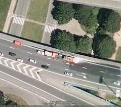
Google Maps. Google also has Google Earth, which shows satellite images taken of the terrain. Example:
Send me an email:
[email protected]
Comment
Post
Cancel
dav3
Confirmed User
Join Date:
May 2007
Posts:
7348
Share
Post
#7
04-23-2010, 06:15 PM
other: gps
Webmasters
::
Juicy Ads
::
ACWM
::
Crak Revenue
::
Money Tree
Comment
Post
Cancel
rowan
Too lazy to set a custom title
Join Date:
Mar 2002
Posts:
17393
Share
Post
#8
04-23-2010, 07:24 PM
Originally posted by
fatfoo
Google Maps. Google also has Google Earth, which shows satellite images taken of the terrain. Example:
Don't forget streetview. Have they done Canada yet?
Comment
Post
Cancel
baddog
So Fucking Banned
Join Date:
Apr 2001
Posts:
107089
Share
Post
#9
04-23-2010, 07:30 PM
Mapquest for my directions, Google maps for my blogs
Comment
Post
Cancel
BVF
Black Vagina Finder
Join Date:
Jan 2002
Posts:
13975
Share
Post
#10
04-23-2010, 07:49 PM
before GPS, I used Mapquest....
Black Pussy
Click On Mr Cosby..CCbill, 60/40, 136 FHG's....The Cos Loves Black Ghetto Pussy!!
Comment
Post
Cancel
Previous
template
Next
Working...
OK
OK
Cancel
😀
😂
🥰
😘
🤢
😎
😞
😡
👍
👎
☕


Comment